


Countryside Voting District, Loudoun County, Virginia
About
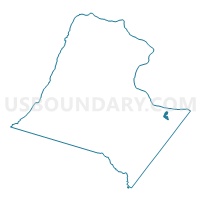
Outline

Summary
| Unique Area Identifier | 682083 |
| Name | Countryside Voting District |
| County | Loudoun County |
| State | Virginia |
| Area (square miles) | 0.64 |
| Land Area (square miles) | 0.63 |
| Water Area (square miles) | 0.01 |
| % of Land Area | 99.14 |
| % of Water Area | 0.86 |
| Latitude of the Internal Point | 39.05053340 |
| Longtitude of the Internal Point | -77.41805100 |
Maps


Graphs
Select a template below for downloading or customizing gragh for Countryside Voting District, Loudoun County, Virginia


Neighbors
Neighoring Voting District (by Name) Neighboring Voting District on the Map
- Algonkian Voting District, Loudoun County, VA
- Cascades Voting District, Loudoun County, VA
- Claude Moore Park Voting District, Loudoun County, VA
- River Bend Voting District, Loudoun County, VA
Top 10 Neighboring County Subdivision (by Population) Neighboring County Subdivision on the Map
Top 10 Neighboring Place (by Population) Neighboring Place on the Map
Top 10 Neighboring Unified School District (by Population) Neighboring Unified School District on the Map
Top 10 Neighboring State Legislative District Lower Chamber (by Population) Neighboring State Legislative District Lower Chamber on the Map
Top 10 Neighboring State Legislative District Upper Chamber (by Population) Neighboring State Legislative District Upper Chamber on the Map
Top 10 Neighboring 111th Congressional District (by Population) Neighboring 111th Congressional District on the Map
Top 10 Neighboring Census Tract (by Population) Neighboring Census Tract on the Map
- Census Tract 6111.02, Loudoun County, VA (6,053)
- Census Tract 6111.01, Loudoun County, VA (4,329)
- Census Tract 6112.07, Loudoun County, VA (3,979)
- Census Tract 6115.01, Loudoun County, VA (3,164)